Most of the data was good if like big snows. However, the 18z GFS took the more north track and was a TON of rain ending as some snow. More like 2-6 inches rather than the BIG event I want.
I tried fooling with GIMP software and it was not cooperating with me. :)
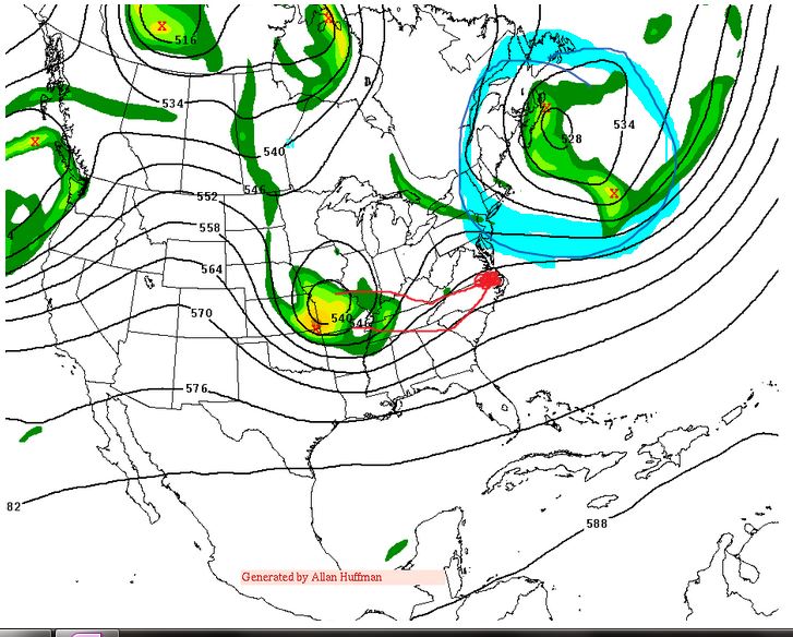
So, this was done ghetto style on one note.
1. I drew two red lines-- One goes down into SC and NE towards Hampton Roads.
the second line goes across Kentucky, along the VA NC line and near Hampton roads.
These are the two presented tracks for the upper air low. For Lynchburg and Roanoke to get a big snow, we REALLY need the southern track. If it touches down in South Carolina, we are golden. If it takes that more northern track we will mix with rain for a while and it gets more complicated.
2. I drew those blue lines up east of Maine, near Nova Scotia, That is tied into point 1. The stronger, more west that it, the better chance we have of driving that energy down into South Carolina. When the 18z GFS had the more north solution, that blocking was weaker.(There is an upper low tied to that blocking as well called a 50/50 low)
While I liked the 12z runs and think it's plausible, as stated-- the north trend ALWAYS scares me.
No comments:
Post a Comment