Sunday, February 28, 2016

Possible Snow event Thursday Night and Friday.

A lot can go wrong still, and we are 5 days out.

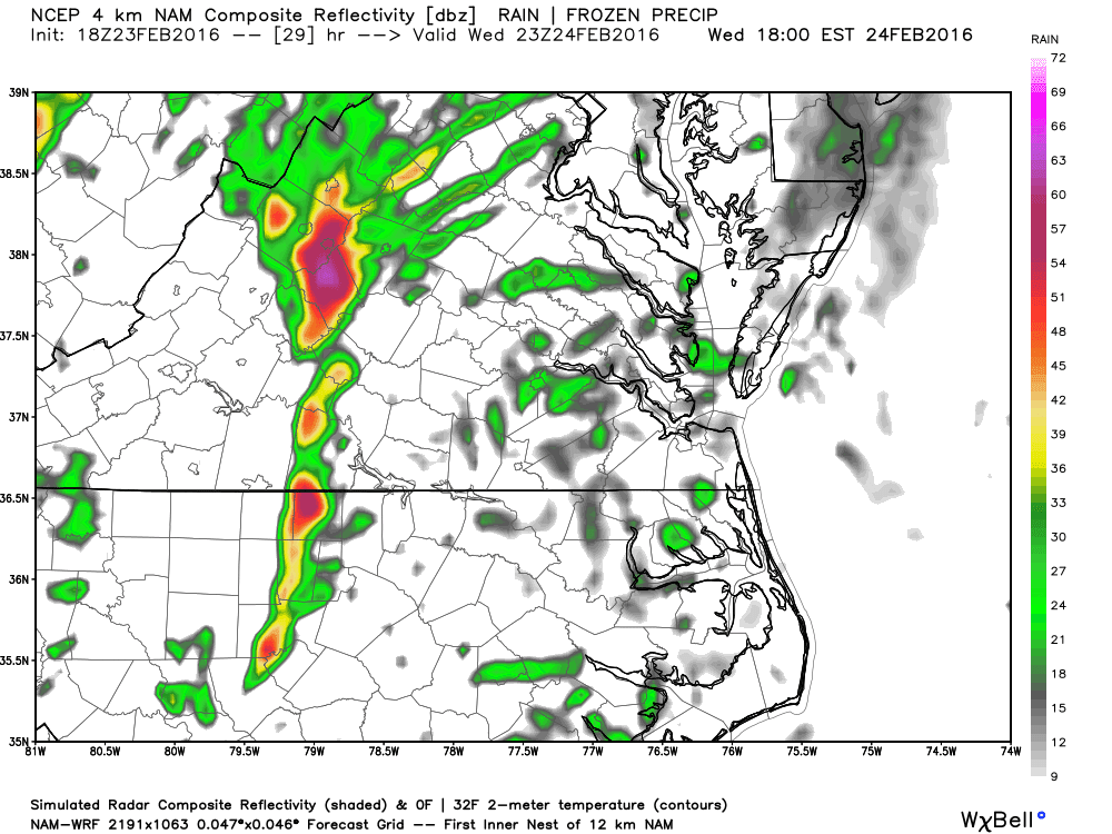
First, another storm will impact our region earlier in the week and bring a round of showers. I don't anticipate severe storms with this event. 

A pretty strong cold front will push into our region with some very cold air for the time of year. A storm will form and impact our region. 

Model break down: 
GFS- Yesterday the model was very fast bringing in the cold air and pushed the low WELL south, it was a MONSTER storm over North Carolina with the heavy snow band reaching the VA/NC border and the 4 inch line reaching 460. Model runs since then lost the storm. 

Canadian: Pretty much has nothing. 

Euro: Has some consistency bring a low due east. There isn't much wiggle room at all as we are on the southern fringe of accumulating snows. I'm not able to post the "paid" snow map I get but the 4-6 inch line basically runs along 460 and basically at the VA/NC line there isn't much snow at all. 


7 PM Thursday- Low pressure is near Nashville. You can see a High Pressure building in as well noted over MN/WI area. On the precipitation maps, snow has broken up north of our region along the Mason Dixon line. 


24 hours later our low is a couple hundred miles off shore and has strengthened nicely. 

Many details to work out. The euro "spits out" 5 inches of snow in LYH and ROA but as the storm approaches, at 1 AM we are actually warm enough for mix or even just rain east of the Blue Ridge, but then as the low wraps up we kick over to a fast heavy period of heavy snow.  (* I can't post the pay euro maps, but these are the free ones in 24 hour increments that don't show precipitation or snow. 

From Charlottesville to Northern Delaware, as the storm blows up the heavy snow that blows up near us really impacts them an dumps 8-14 inches. 

If you don't want snow-- Speed the storm up and don't let he cold air get in place. THis would result in a more north storm track.

If you want MORE snow- slow the storm up, get the cold air in faster. Rather than a Nashville to Boone to Greensboro track, get a Chattanooga to Charlotte track. That extra 75 miles will make all the difference. 

The storm BOOKS out of here Friday Morning and Friday afternoon temps are back into the 40's via the European model.. March snows, in fast and out fast. 

My thoughts: There are some reasons why we could see a more suppressed track with cold air moving in. However, many reasons why we could see this thing trend 100 miles north and we just get a few rain showers too. No call yet, but my inclination is to expect a more northern track at this point. 

Tuesday, February 23, 2016

Severe Weather Threat...

First, my Grand Finale is looking more and more like Delaware City or even worse, but I still have hope for the period Match 5-15. Obviously, The clock is running and every day the sunlight is a little longer and brighter and my time is close to running out. Snow Haters, don't spike the ball just yet.

Tomorrow: Our storm we tracked last week for Wednesday is now going well west and presents a severe weather threat. Now, there are factors that could limit this, especially areas along and west of the Blue Ridge. With that, I wanted to make you all aware of this.

Looking at SIM radar, it seems two waves of showers and storms come through, the second being the greatest threat to have tornadic activity.


This is Radar right around 5 with the second round moving through. 


You can see our storm starts near SML and strengthens as it moves rapidly NE from there. 

4pm MAP of greatest risk for Tornado..


One hour later  the risk has shifted east. 


I'm honestly skeptical places just north of Martinsville to just south of Lynchburg see severe storms. There will be a cold air wedge in places and the models QUICKLY move out the wedge and then stir up some storms. 


Not our area temps in the 40's with much warmer air to our east.  at 1PM


3 hours later, we've spiked to near 60 and Tornadic cells are are supposed to form. Now, I'd never rule out anything from happening but I can't remember a time where in our area that we've had a wedge break and tornadic cells pop up that quickly. I would contend that based on climatology alone, the highest risk is east of a line from Danville to Pamplin. With that, please be aware of all the weather reports and be cognizant of all watches and warnings issued tomorrow. If the sun pops out late morning early afternoon, it could mean game on. I'll tweet out and FB update information as it comes available. 

Saturday, February 20, 2016

How do you find Will Smith in the snow?

You look for the Fresh Prints..


Today should be a VERY nice day, temps up near 60. 

Tomorrow will be warm as well, but there is a shot for some showers in the afternoon, which could ruin outside time. 

Next weeks event: Trending more like NOT much of anything but rain. Anytime there is some dry air, a 20 minute sleet shower is possible and sometimes if it starts right around dawn, a little freezing rain takes place. With that, the bulk will be rain and it could be a big rain. Much of next week Sunday till Thursday could have some rain each day. 


How's the Grand Finale Looking?? I still like my prediction of one significant and one minor event before spring kicks in. On January 6, I stated no changes to my overall ideas for the winter, conceding that December was much warmer than I thought. 15 days later, we were on the Eve of our big event. 

If I had to pick a date, March 7th, give or take 4 days for those events to happen. (Let's say the week From March 4th to March 11th look best.

PNA: Measures ridging on the west coast.. looks positive, that's good
AO: Measures blocking over the north pole ...looks negative, that's good
NAO: Blocking in the Atlantic to lock in cold air ... looks negative, looks good. 
EPO: Ridge/Block over Alaska, BONUS cold air. .. looks negative, indicating blocking over Alaska. All good signs. 

If the patterns does not develop as I expect, we could be looking at a "Delaware City Finale"

Shortly after this, the pattern will break down March 15th ish... and Spring emerges. 


Wednesday, February 17, 2016

We're heading to the GRAND FINALE!

 Winter has one last stand and like a good firework display, the GRAND FINALE could be incredible for you snow lovers and miserable for you heat misers.


Growing up, I can remember 3 types of Grand Finales:

1. The standard. My great grandmother owned a house at Slaughters Beach, a location about 20 miles north of Rehoboth Beach, Delaware. The Fire Company hosted the fireworks each year and once the siren went off, the show started and it was a normal  fun grand finale to end the show. 

2. The Phillies game. My family went up to a Phillies game when I was 10 or so to see the 4th of July display. I figured the show would be pretty incredible and from the second the "Power 99" (local radio station sponsor) started shooting out sparks, my jaw dropped in amazement until the show was over. The Grand Finale is still the benchmark by which I grade all firework shows. 

3. Delaware City. One year we stopped someplace new because we were not going to my grandmothers. Some of the shells didn't launch high enough and pieces of burning paper fell in the crowd. During the grand finale, the first firework didn't blast high enough and each subsequent firework got caught in the wake and blew up. There was a ton of noise, but no fancy light show at all. I look back and laugh because it was that bad and such a let down. 


Winter has until about March 10th or so based on the pattern. I see three ways to have OUR Grand Finale of this Winter. 

1. We get ONE more storm above 6 inches and one storm below 4 inches. We'd be above normal snowfall for the winter but within the range I predicted based on the Strong Basin wide, but more western based El Nino. 

2. We Get a Phillies game with 2 or more events over 6 inches and a couple of other minor events. This will put us on the EDGE of a top 10 winter in our area snowfall wise. 

3. We get Delaware City-- Had a lot of potential but something goes wrong and we are done for the year snowfall wise. My winter outlook falls short, snow loves give me a sympathy pat on the back while you snow haters cackle into what could be a SUPER LA NINA next winter, which are often warm with reduced snow. 

Good news for those of you who don't like snow-- I think when the pattern change mid March, The End of the month is actually pretty nice/warm In like a Lion, Out like a Lamb. 

I'm going to hedge on a good Ole Slaughters Beach Grand Finale. You'll be impressed, but you'll know there were better events and better years. 

Next Weeks Event:

The weekend will be great with 60-65 degrees Saturday and Sunday. Some cooler air filters in Monday and while some COLD air moves in from the west a storm approaches from the SouthWest on Tuesday. 

My take is the best potential now makes this the "under 4" inch event as cold air is LATE getting here and we pull something out late, but the bulk of a strong and wet storm is liquid, not frozen. West Virginia into PA does very well away from the coast. 

What is needed: It is presenting as a two wave system. Wave one is all rain, wave two is rain ending as snow, some model data has 10 inches Roanoke/NV and 4-6 LYH. If we can get the cold air in faster and slow the storm up, we could make this a bigger event. 

On this map below, note how there is a storm over New Foundland, This will bring in cold air and you can see a high pressure centered over  MN and that SHOULD be pushing cold air in our region. This is Tuesday Night at 7PM.

This is Wednesday Night at 7PM-- Cold high anchored over Southeast Canada  and broad low over SC/GA. The map is actually very warm at the surface, but SHOULD be colder.
Note that 12 hours later, our low is NE of VAB. If we get This time frame, we could see a 4+ snowfall. Anything sooner, I fear the models would SHOW a few inches but we'd end up disappointed. 

So, with this being round one of our "Winter Grand Finale" I will watch this event closely. This will be a BIG storm for some areas.. Foot plus. I think we catch a little something, but the severe totals will be 100 miles or more north and west of us. IF that cold air finds it's way in sooner OR if the storm is 12 hours slower, we could be looking at January 22  all over again. 

If this falls apart, we should have 2-3 more shots at some snow and ice after this. 

Keep up the clicks! You all rock. 


Tuesday, February 16, 2016

Storm wrap up and looking forward..

The GREAT storm has come and gone and WOW, we are right on the edge of damaging ice storm and we JUST escaped with relatively minor damage.

What I forecasted

What Happened

Ice pushed the limits to what could have been a damaging storm but the temps just warmed up. about 5 am, the ice stopped building up when temps hit 32 or so. 

Tonight could see a rain or snow shower, but I don't expect any big deal to come from it. 

Warm this weekend:

Saturday Estimate high:

Sunday EVEN BETTER! 

Looking ahead: After our great weekend, a series of cold fronts comes through and then a storm is forecast to form along the cold front. The European model today was JUST cold enough to start as snow and dumped 10-15 inches of snow region wide. Other model runs are just off shore or a little warm. 

Now, we know I operate from a position snow is a good thing. So, if you don't want snow, hope for the opposite of this. 

1. We need to cold air to get in place. Some data suggest VERY marginal air temps with under full sunshine, the freezing line would be near Canada. However, VERY cold air is just behind this storm. 

2. We could hope for a slower storm-- If the main energy comes out lets say Wednesday or Thursday our odds are much better than if we get a slower storm. 

3. Sometimes model data runs a little warm a few days out-- so it could be a little colder than modeled. 

As of now, I'm not too crazy about this storm. This past storm I felt good thinking we'd get something, if even 1-2 inches. With this storm, my fear is by Sunday there is a primary low going into Kentucky (placing us on the warm side) and a second low forms near Wallops Island, meaning a big PA and NY snow. 

Even if this one doesn't pan out, I believe we have 2-3 more shots at something after this. We need a few more inches each location to at least verify my winter snowfall outlooks. 

Thanks for the clicks on the ads! You all really impressed me. I'm up to 500 likes on facebook so continue to share with your friends. 


Monday, February 15, 2016

Early Morning update...

The storm is behaving reasonably well.. Here is a rough estimate of my snow total so far down on Timberlake road.

It's 4.5 in this picture and that was an hour ago. I took a long walk and really enjoyed it. Snow ratios are REALLY good now, north of 15-1.

Most areas are within our 3-6 range, I think that Northern Amherst and Down near Danville may need to catch up a little but outside of that, we are on target. 

This was somewhat bonus snows.. I didn't believe we'd be at almost 5 inches by now.  Radar looks good, with that I've seens things NOT behave before. 

So, down along the VA/NC border Martinsville east, another 1-2 inches. 

The 460 Corridor, I think we get another 2-4. Many places could exceed 6 inches when all is said and done. Remember, I'd always rather go up then come down with snow totals.

Once the snow mixes, it should shut off within an hour or two. After that, light freezing drizzle should develop mid afternoon. The cold air finally gives up LATE tonight, As late as 4-5 am Tuesday Morning, some places in sheltered valleys. I think icing gets to the point where we start to get concerned and then it changes over. Some minor power issues likely, so be ready.


Sunday, February 14, 2016

I Choo Choo Choose you!

Happy Valentines day one and all and if you don't have a Valentine, let this card fill that void!


Winter Storm Warnings are up region wide...


The Pink areas have been upgraded while the other regions are either advisories, or watches. We did hit single digits last night here in Lynchburg with a 7 spot on the board as of 5 am. Roanoke has been as low as 10 and I imagine one of those in between hour observations met our goal of single digit lows. 

The storm is moving faster. Start times in the west regions COULD be as early as 5pm, I think the 8 or 9 PM, the first flakes are into Lynchburg.  The earlier start time won't translate to more snow because it just means we mix sooner. Mixing COULD be in Southside pre Dawn and Lynchburg as early as 9 am. First sleet mixes in and then by mid afternoon we should have completed the transition to freezing rain in Lynchburg. Sleet may linger a littler longer out in Roanoke and other places along 81. 

Here are my broad ideas about the storm. My map may not match XYZ vendor, it happens.  


Some ideas and pit falls:
1. I think that the Mt. Empire and NRV into the Roanoke Vally, up 81 to Lexington are the Jackpot areas for snow. Would not be shocked if a person reports a 10 inch total that way. 

2. Some model data has had one maximum east of the Blue Ridge VERY south near the NC border and another NORTH of Lynchburg near Charlottesville. We could verify on the low end of the 3-6 inches. 

3. I think the worst ice falls in a triangle from near Lynchburg to Charlottesville to Winchester.

4. The window for snow is about 12-15 hours.  After the transition to sleet and then freezing rain precipitation stops. This lasts for about 8 hours. During this time, light freezing drizzle will be falling. 

5. Between 4 am and 7 am, places most places make it above freezing JUST as some very heavy rain comes in. Rainfall, falling as just rain could reach up to an inch. 

Cold air damming. 

Cold air damming (No, not what you want to say to the cold when it's 5 degrees outside) is cold air being trapped against the MTS, preventing it from leaving. Cold air is heavier than warmer air and is hard to dislodge. Sometimes once you're just 500 feet up, it's above freezing but down near the ground it's cold. 

Here is a 4pm map Monday, you can see the cold air holding WAY down to near Charlotte. 


At 1 Am Tuesday,  It's getting smaller. 


and at 4 am most places are above Freezing. 


What saves us from a REALLY bad ice storm is that the cold are finally breaks down as some heavy rain approaches from the west. Most of the time from 4pm or so until 1 am will be light freezing drizzle. Here is SIM radar at 1 PM monday, most of the precipitation as moved out. 


And at 7 PM


Finally, 1 AM 


We are fortunate that for 12 hours we have temps in the mid and upper 20's and it's just light freezing drizzle. Once that heavy band moves in, we are above freezing in about 2-3 hours. This is preventing a significant ice event. Places east of the Blue Ridge may see 1 to 1.5 inches of rain from that band. With temps in the mid 40's Tuesday afternoon, we could see about a total melt off. 


Saturday, February 13, 2016

Bigger than Michael J Fox and Celine Dion.

Jim Carey, Wayne Gretzky, Justin Bieber, this storm?

MOST of the model data agrees with the colder part of the storm. Snow moves in overnight Sunday and lasts till Noonish Monday before mixing and changing to sleet and freezing rain. Freezing rain and sleet change over sometime Monday evening or overnight into Tuesday.

The Canadian keeps the cold locked in longer, keeps the low south and dumps 12-16 inches region wide. If anything like the Canadian happens, move over Wayne Gretzky, we have another Great One!


The Euro still wants to drive the low pressure into the mountains and swing it over our heads directly.

My take is both models are having issues.

There is some divergence still on the storm track of the main low, with the european STILL driving the low across the mountains at an odd angle and REALLY warming things up. My take is to blend the models and really keep close to my forecast from yesterday.

Most places- Snow Develops near midnight Sunday. Snow lasts till about Noon Monday and then mixes and changes to sleet and then freezing rain by mid afternoon. Ice takes over and lasts till near Midnight Tuesday. Rain ends by Noon Tuesday.

Snowfall totals :Draw a line from Martinsville to Chatham 1-4 inches Southeast of that line. Everywhere else NORTH of that line 3-6 inches. A few spots may get up to 8 inches especially in the Mountains or where some heavier bands set up.

Something to watch would be a thin heavier band setting up somewhere. One run of the NAM model had it along 460 from Blacksburg to Farmville and dumped 6-10 inches really fast. For you NFL fans, if you think of the SnowGlobe game between the Eagles and Lions a few years ago, a 1-3 inch snowfall became 6-9 in a few hours from a band like that. As we get closer to this event, the high resolution models COULD pick up on something like this.

Ice Accumulations: .10 to .25 inches. Some minor power outages likely, but I think we warm just enough before heavier rain gets in PLUS temps push towards freezing quickly where freezing rain and 32 is not as bad as 26 and freezing rain.

Not a bad event and I have some work to do on my winter snowfall totals, so I'll take what I can get.

Our warm up is a bit delayed from this storm but we do get a few nice days over the weekend NEXT week with temps in the 60's.

I think Feb 24th through March 10th or so look cold/ stormy and gives me a shot a verifying my winter snow totals. I'd take that shot rather than having NO shot at all.


Friday, February 12, 2016

A Model Idiot?

The models are struggling with this event and it's not unexpected. With VERY cold air in place, being dislodged as the storm comes in, the models are struggling. I expect the models to trend much colder as we approach this event.


at 84 hours, here is the GFS (American model) It's trying to hold cold air in place to the east, but eroding it to the west. As a result, it's 31 in Richmond with snow and 40 with Rain in Roanoke (1pm Monday) This never happens.

At this point, there has been a couple of inches of snow. 


Here is the NAM at the same time. 

The wedge is in much better shape and we've had as modeled, 3-6 inches in our region. What happens is warmed air overruns the cold air trapped against the mountains. This reinforces the cold air to hold in place longer.  It would infer that snow would be here sooner and heavier. 


There should be some type of a 30 mile wide band of heavy snow that develops. Being on the southern fringe 84 hours, may not bode well BUT once it gets a full grip on the cold air in place, it may actually trend south before it trends north again. 

What does this mean?

Snow starts after midnight Monday west and races east by 3 AM (Lynchburg area) Monday is pretty snowy, could be heavy at times with 1-3 near the VA/NC state line, mixing early and 3-6  HWY 460 north. This will eventually mix and change to freezing rain from 460 north and back to I-81. Could be as early as early evening Monday, could be as late as Midnight. I think we stay below freezing until Tuesday AM.  If we change early that 1-3 south, 3-6 north will be the ballpark of total snow. IF we can cling to snow until Midnight or later, those totals could double. Then we tack on some sleet and freezing rain. 


Here is a sounding at 84 for LYH (1pm Monday). I've circled the temps.. the lower you go on the chart I posted, the higher the you are in the sky. You see some temps between -1.5 and -2.  I suspect the warmth comes in the area that is near -3. I would suspect this is at least a few more hours of snow. Height in second column is elevation in meters. This model isn't great at 84 hours, but I think the better resolution is catching on sooner. 


I will continue to tweet out thoughts as model runs continue. I do have growing concerns about power issues in the Roanoke and Lynchburg area. Even if we just get 3-6 inches of snow and then freezing rain, the weight of the snow PLUS adding on ice could be BIG trouble for trees and power lines. Double those snow totals and it's even worse


Thursday, February 11, 2016

One half second too slow, too fast and you don't quite catch it...

Long day of glancing at the models in between working hours ends with no clear idea. In the end, it's all about timing.

The model runs that are faster with the storm, bring us the most snow.  The models that are slower, because the cold air is fleeing fast end up icy and rainy. I just saw the euro and it's a nice compromise compared to where it was before.


The fast models bring in snow before sunrise Monday and lasts most of the day. By evening, ice has reached Lynchburg and the worst ends by pre dawn, if not sooner. (Little moisture left by 1 am, I imagine Freezing drizzle falling most of the night) Temps are well below Freezing as the storm ends.

The slower runs at times hold off the snow until Monday evening and then quickly break down the cold air wedge, going from a little snow to ice and then rain. Some of those runs have the bulk of the rain being Tuesday when the cold air is all but gone.

The key because the cold air is leaving is the speed of the storm. The slower solutions do end up with more total precipitation because the flow of moisture last longer.

So:

Fast solution: Snow develops pre dawn and snows all day. Mixing first southside, then Lynchburg late afternoon finally into the Roanoke and NRV as it ends, 2-4 southside with ice, 3-6 LYH with ice, 5-10 with ice Blue Ride West. Storm is gone shortly after midnight, but I imagine some freezing drizzle and flurries could linger over night.

Slow Solution. Flurries afternoon Monday, some snow  early evening and then ice into the overnight, could be heavy, eventually flipping to rain. The further north and west you get, the more accumulations you get. If this pans out, I would see southside with little or no snow and some ice, LYH at 1-2 inches at BEST of snow and ice ending as rain Tuesday. Roanoke 3-6 with ice ending as rain Tuesday. These solutions linger rain or possibly ice into Tuesday Afternoon.

It's about a 12 hour difference in timing. We could blend these two ideas as our final outcome.

No real model consistency, but I just saw the euro and after being the SLOW solution, it has gone to the fast solution. The PARA Euro, (Upgraded version, still in beta testing) has somewhat this look. I won't see the Para until after 8am or so tomorrow. Before the euro, I was hedging a stronger front running Monday, a break and then more ice Monday night, but the Euro is a nice compromise. Euro has most places over to ice by 7pm Monday, but it was a healthy 3-4 inches southside, to 5-6 near LYH to 5-10 western regions.

For those worried about power outages if we see big ice, I don't think this is a set up for widespread power issues. Usually you'd want to see moderate freezing rain for house with temps holding mid 20's or below. This would have temps in the mid 20's sky rocketing towards freezing fast and HEAVY stuff falling. Yes, it would have SOME power outages, but it won't be 1994 all over again.

I'll tweet out something when I see the PARA Euro between 8 and 9 am tomorrow.

Tuesday, February 9, 2016

Let me elaborate on Single Digit Cold and Double Digit Snows..

And how the Euro backed off a little last night.

We will get some very cold temps this week.

First, the event yesterday went as predicted with some rain, a little snow and temps did bottom out last night below freezing so watch out for black ice. A few flurries are possible today, maybe even a snow shower.

The euro yesterday showed low temps Sunday below 10 most regions and then a NICE storm that dumped double digit snows in our region. Last night's run had lows closer to 10, with the snow more like 6-8 inches and ending as ice places east of the Blue Ridge (Lynchburg and Danville)

Other models: GFS had a weak low to our north while the Canadian (CMC) had a look close the the Euro.

Take Aways: We will have some serious cold. The storm has some issues with cold air leaving, timing where if it's a day late we get nothing and there is ANOTHER short wave (Energy aloft) right behind it. The Euro ensembles look better for snow than they did noon yesterday, but are not perfect and I've not seen the PARA euro (new version of euro in beta phase) missed off the coast yesterday. 

I would classify this as the "monitor" phase.. not a threat phase yet. If it comes to fruition, it will be a Monday possible ending Tuesday, but a fast mover.