Monday, December 25, 2017

Christmas week cold and storm threats! 2 or more "shots" at hand, yes I am serious, Clark.

If we could "flip" Christmas and New Years!

First, Merry Christmas to all!  Hope your holiday season is filled with love, joy and peace. My 9 year old is almost sure that Santa isn't real, but I just caught him red handed in my house..

I was snapping a pic of my tree..

Had a second pic that looked like "this".. 


So, the cold is a little later getting here or we could be talking about a little threat tonight. With that, Grandma's cabin up at 3k feet may see a litle snow up in West Virginia. 

We remain cold Christmas week. Model data has been insistent that we see some snow in the next 10-15 days but it can't figure out when/how much.  Breaking down the details. The ensemble numbers have been impressive with near double digit totals for the 15 day period.  

1. We will have plent of cold/air in place and a "pattern" that supports snow/ice.
2. 2 maybe 3 shots at hand.
3. Details are sketchy, The models have gone from a focus on the Friday event, to a focus on the New Years eve/day event. There is some hints at another event Jan 5/6 which could be the "breaking the cold" storm. 
4. Details are are hard with a faster jet, finding the right short wave to amplify is a challenge. Legit shot we get next to nothing and legit shot we score some snow on maybe all 3 events. This is more of an awareness post :)

Friday's event- At this point looks to be a southern slilder, with somewhat of a lack of moistuer. As modeled, if we "max" the potential a 2-4 incher is possible, and a total miss to our south is possible. Worth tracking- moving a storm 100 miles NW on the models in 5 days is not hard at all, but this is less than ideal and  very werid set up with cold in place but a second low in the Great lakes and at one point 4 areas of low pressure. 

New Years Eve-Day is on some models. The Euro model last run had the cold overwhelm the pattern. Some hints it could be a classic coastal low, (Nor Easter, Maybe  a Miller A)  Not a lock, but worth watching. 

Jan 5-6- Just looking at patterns and longer term ensemble members display a threat. No specifics. Often, as cold leaves and the pattern breaks down you get a  See ya! Storm. 

Will updated as needed. This evenings GFS/GGEM (American and Canadian) displayed a close call with Friday and more significant event Sunday.

Will blog when more details are needed. Look for updates on Facebook/Twitter and share with your family and friends. If you're bored.. click an ad :)


Friday, December 8, 2017

Full Snowstorm update 5 am , Friday Dec 8th.

I get that no one else is calling for a major storm yet. No model, NONE doens't give our area a big snow.  NWS has issues a Winter Weather Advisory for the NC/VA border states for 1-3 inches of snow. Our forecast is for a 50% chance of snow.

Last nights call:
1-3 West of 81.
2-4 LYH to ROA
3-6 Southside.

I'm going to hold those I see the noon data. If noon data shows the same information, I will double thouse totals (approx). We just need to train a little more.. :)


3-6  along 81  including Roanoke/Blackburg
4 to 8 Lynchburg to Danville Back west to Galax.

Crazy in that some areas may have some rain or snow falling by then.

The big issue is we have our low in the gulf, and it gets renergize by energy from the clipper energy aloft. This won't happen until late evening and overnight. I imagine our heaviest snows will be pre dawn tomorrow into late morning.  Restated - Our best snows fall towards Morning tomorrow and the bulk of the morning tomorrow. There could be some rain mixed in or even straight rain falling today. **If this pans out, our accumulating snow falls late tonight and tomorrow am**

Still a high risk bust event. Waiting on a storm to fire up overhead is RISKY! Things can go wrong.

Some maps!
This map is the short term Canadian. This is 10 am tomorrow morning. Heavy snow extends back to the blue ridge.

These two are from the latest run of the GFS. So the snow map could be a little overdone with some snow from today melts or falls as rain. But, shows the moisture. 

In summary, HOLDING with our calls but will double if the models hold..(Not doubling southside exactly) The short term models (Higher resolution) start around 9 am and the Euro at 1pm. Will tweet/post updates in run. 

When it's snowing heavy tomorrow morning and you hear a yell, It may be this guy!


Thursday, December 7, 2017

6pm fast update 12/7/17- What is going on..Snow expected

 Model data has trended to a more snowy look.

Why?

1.Low in the Gulf was progged to head NE to a spot off the NC coast but be weak. A Clipper system and it's upper air energy didn't look to interact much. The model runs that showed snow had some level of interaction

2. Last night ALL data trended away from a low being close enough for snow.

3. Noon data showed more interaction or phasing between the clipper system over The Great Lakes and our storm in the Gulf. The result is a slower system that is stronger ( Maybe sub 1000 mb east of Hattaras)

4, Snow may be in southside mid morning, up to 460 by mid afternoon, but that's just the teaser.

5. The bulk of our accumulating snows will come overnight into Saturday. There may even be a lull the bulk of Friday evening.

Best guess
East of 81 Roanoke to Lynchburg 2-4
Southside  3-6. (Martinsville, Danville
West of 8 1 1-3

If the trends continue, we could up those especially in the Roanoke and Lynchburg area.. and at some point mixing could be an issue in Southside areas.

Please share this with family and friends.


Rapidly changing data.. expect a ton of data tonight. 

Wednesday, November 29, 2017

It gets cold, then what??

Most of my friends and followers for my weather stuff likely follow other weather resources ( Yes, I consider that cheating :))  Haha, I should make a list of good people to follow (Kevin Myatt, Blue Ridge Weather, Wxrisk) and those to avoid (DooleyCaster)

So, this means that most knew the pattern change to cold was coming.  However, what it means in your backyard is much different.  Here are a few thoughts.

1. It will be cold by December 7th. Well below normal for a few days here and there and seasonable cold many other days.  Normal to above will be limited, but still happen.
2. The pattern looks more cold than not through December 20th, then make sink back colder after a lull or small break. Most data supports cold through the end of December and maybe even into the first 2 weeks of January. (The further out we get, the more risk is involved with that statement)
3. Most people care mostly about snow chances. Now, I do love a cold brisk day.. but reality is cold without snow kinda sucks. So, what do we know about snow changes.
A. No specific threats to really track. The models have flashed a couple of things starting December 7th, but nothing at all to "track".
B. It's not out of the relm that we don't see a decent snow, even though it will be cold.
C. With that, It's been snowless in December since 2010, and I think odds are greater than 50% that we break that streak.

Types of storms that impact our area (Central and Southwest VA, including Lynchburg, Danville, Roanoke and Blacksburg) that bring ice/snow to the region. 

1. Nor Easter, Coastal lows(Also called Miller A )- These are the classic big storms. They originate in the Gulf and head up the coast. These have the most potential for big events.

Risk of mix- high, especially east of the blue ridge.
These storms often deepen quickly, which creates for stronger winds.

2. West of the Mountains (Miller B)
These storms form in the south/west and end up west of the mountains. At some point, the jump to the coast, 99%of the time too far north to impact our area.

These often start as snow, change to ice and eventually rain. Snow amounts can be small to at times significant (each set up is different, and is dependent on the strength and depth of the cold air in place

3. Clipper systems (Alberta, not Los Angelos)
These systems originate over the Alberta Region of Canada and head south east. Most often, the pass to our north, but in times of strong blocking, will dip over our region. These systems are usually in the 1-3/2-4 inch amounts with the occasional amounts hitting the 3-6 inch range.

4. Overrunning-
No realy defined low pressure, but cold air in place and the flow aloft turns to the south and southwest pushing warm air our direction). These systems vary from ice events to decent snow events. Bigger overunning events can be in the 6-12 inch area, but more often are a few inches that changes to ice ( Think this way, if there is cold air in place and warm air pushes in, it would eventually change to ice/rain unless more cold pushes in

5. Souther slider- A coastal low like a nor easter that heads out to sea near the NC coast rather than up the coas.t

Less likely to mix, can be a big or biggest event

Now, these are labels we put on storms and not every storm falls into a box like I've described.  Once  we have a few storms to track, this is a handy glossery to use when I start talking about storm tracks.

Sunday, November 19, 2017

A winter outlook so to speak..

In the past I have done a more in depth write up and conveyed more "personal"ideas about what may happen in the upcoming winter. In General, long range at some levels is more of a "good guess" area rather than skill. Often I read many outlooks then do some local research and put out a forecast. This year,  I have some ideas

This year we have two schools of thought.

1. Normal "La nina" winters which would favor milder tems and less snow/dry. 

2. Other impacted "La Nina "winters which would feature more snow/maybe more snow. 
- Other impacts are the QBO, Hurricane season and global SST's. 

Analog years are harder in the context of weather or not you are a "believer" in some type of climate change, the globe is very warm and this does impact our sensible weather.  You could go above normal temps in an season at this point and be correct maybe 80% of the time. 

For our area (Lynchburg, Roanoke, Danville, Blacksburg) I'm to hedge colder, with below normal snow, but due to ice/mix and dryness. 

Temps- All Areas Normal to -1. I do think we see a couple of significant artic outbreaks. Let's be honest, if our lows are in the single digits with wind chills, kids are getting snow/Cold  days  from school. 

Snowfall- 
Danville 2-12 inches
Lynchburg 5 to 15 inches
Roanoke 7 to 17 inches
Blacksburg 11-21 inches. 

Upslope regions will be above normal (those places that just snow when it's cold)

Why the weird snowfall range?
La Nina winters tend to lack  the sub tropical Jet.  With that you tend to have system that are a smidge to north for our region. Storm track may feature systems going into eastern Kentucky then jump to the coast north of our region. Those are classic snow to mix or just mix events here. The risk for increase blocking could push those to our south under the block and increase our snowfall.

Snowfall is a guess at best, so take that for a grain of salt. I'd expect a little drier than normal winter. IF we over achieve on blocking (Blocking up north pushes cold air south) during an active storm pattern, we could easily over achieve on snowfall.

Be ready for frequent twitter, facebook and blog updates when pattern changes arive. We should remain seasonable chilly for the rest of the month. Good bet that we remain snow/ice free through mid December. 

Thursday, September 7, 2017

The impact of Irma on Roanoke, Lynchburg , Danville and Blacksburg

So, the blog has been dusted off for Irma. I'm a shameless winter guy but this is a big deal event in some areas and worth sharing ideas about. If you are reading this blog, again this is a discussion for Lynchburg, Danville, Roanoke and Blacksburg region.

Key phrase for our region:
Know the difference between disruptive and catastrophic.

Harvey was catastrophic in 2 ways.

1. The landfall region was horrible. Stormchaser iCyclone was in that region noted Click here for Harvey Landfall
2. The flooding was caused by the lack of movement and 30-50 inches of rainfall over a large region including Houston Metro.

Irma has been and will be catastrophic in a large area. Most have already viewed the footage from St. Martin and Barbados which are humanly horrific and hard to watch.

The track that is possible of destroying the more islands, avoiding Hispaniolia and Cuba as it gets a little stronger over the warmer water, landfall near Miami, then head due north just off shore (note the slight curve of the coast that could allow a due north track to get just off shore). This allows the eyewall scrape almost the distance of the eastern Florida coastline, a short timeover water before a final landfall in South Carolina region. Adding, a large storm like this has an expansive wind field and a larger storm surge. Most of that region will experience a catastrophic event.


Meanwhile, we don't really know what  the impact will here because the track has yet to be determined this far north.

Worse Case scenario: Irma Tracks from Landfall in SC to a Point near Martinsville/Galax area. most of the region sees 2-6 inches of rain and wind gust could reach 70mph, especially nearest the storm and the highest elevations.

In that case, we see some flooding, a good amount of power outages and life is disruptive a few days to maybe a week. It may be a challenge to get a hot meal, some power outages, local flooding in flood proned areas, but nothing remotely close to what we have noted in the islands so far  or what will happen over the those who get the direct impact of a Cat 4 or 5 system. In our region, Tropical Storm conditions are a worst case scenario.

Current trends have been a secondary landfall in South Carolina and a westward movement that keeps the worst away from us. We'd see winds up to maybe 30mph and under 2 inches of rain.

We could also have a mid track that meets those conditions in the middle, with up to 4 inches of rain and wind gusts up to 50 mph.

 Point being, it's always smart to check flash lights , candles and batteries. It is always smart to have some non-perishables and keep some water bottles handy in our region of Western Virginia.  Even if this event isn't a big deal, you are protected agains a future ice storm, derecho and even zombie outbreak. However, there is little or no chance of a catastrophic event here. In a worst case scenario, we have up to a week of smaller disruptions in smaller areas.

Supporting my point that we wont have a catastrophic event here..here are the local observations from Fran in 1996. Our highest winds were gusts to 36 and 6 inches of rain total. Rain and winds at 30mph is a lot more intense then one would recall and I lived in a second story apartment with cheap windows and the wind pushed the rain over the top of the window and leaked in that way. But, by 2 pm the sun was out and I went to the J Crew sidewalk sale in Forest.


Summary: Those in the Bahamas, Turks and Caicos, Florida will have a horrific and life changing event.  Failure to head warning will have significant consaquences including loss of life. 

In our region, in a worse case scenario we have a disruptive event. At this point, we don't have enough information for a "exact" forecast at this point. 
I'll throw another update or two out there in the next few days.

Sunday, March 12, 2017

How Much Snow Monday night and Tuesday??

I'll start with the details and then elaborate for those who care!

New River Valley up 81 to past Roanoke 3 to 6, up to the Blue Ridge.

East of the Blue Ridge - North of Altavista , Cutting north to Farmville , Including Lynchburg 2-4.

Martnsville, Danville, Ect coating to 2 inches.

If this is a Dud: Ending as snow in NRV, LYH and ROA and all Rain southside.

If we over achieve, 4 to 8 NRV, ROA and LYH, 2 to 4 down to Martinsville and Danville.


Discussion:
If this were January, we'd be looking at 6-10 inches region wide, maybe some bonus snows in the north and east areas. It's not too warm, it's just March, mid March at that.

To not overcomplicate my discussion,  we have storms that are phased and unphased, Phase, simply put is when 2 branches of the jet streams, and their upper air energy work together.

Early on, a phase seemed likely, then models moved away from that. Today, they are more phased and the net gain is best snows should be west of the Blue Ridge.

What a phase does is strenghten the low fast enough to cool the air from top to bottom by creating strong vertical motion upwards.  The models currently strengthen the low a little sooner and enough cold is in place along -81 for mostly snow, or rain changing to snow. As the low deepens and pulls east a rapid change over takes place. However, the snow ends pretty quickly after it changes over with maybe 2-3 hours of accumulating snow and then 2-3 hours of light snow and flurries.


Details:
Roaonoke and NRV, a mix of snow, sleet and rain develops late afternoon, changing to all snow in the evening. Snow will be briefly heavy. Snow ends in the pre dawn hours. 3 to 6 on colder surfaces, slushy mess on roads, etc.

Area including Lynchburg: Rain and sleet develop, maybe all rain for a while then changing to snow. Snow could be heavy an hour or three, before ending as 2-3 hours of light snow and flurries. It's gone by sunrise with 2-4 inches falling, mainly grassy areas. The roads will have some slush on them..

Southside. Rain and maybe a little sleet ending as snow, coating to 2 inches.

Crazy talk: In my "weather chats" with various people I've predicted that if the  low deepens to 995mb before Cape Hatteras we see 4-8 in all areas except southside. I still believe that. I think we miss it by 50-75 miles. (AKA, Past the VA/NC border.

More Crazy talk: Pretty good odds school is out Tuesday. Snow will be gone by noon. Gone, as in melted.

Even More Crazy Talk: Winter is hanging on a little after NO winter. May need to blog later about other events.

What can go wrong? If the low is SLOWER deepining, we get some rain ending as lighter snow, but no accumulations to speak of.

If you're up, the snow may rock a couple hours nice big flakes from 10pm to 3am.
Thunder, as the low deepens with both the rain and snow is possible.

Huge event just north of DC. My baby sis lives 20 miles NW of Philly near where I was raised, I think she sees 12-20 inches.

I think that the NWS will go Winter Weather advisory for most areas NOT southside and MAYBE winter storm watches/warnings for Amherst, Bortetourt and Rockbridge Counties.

Doubt I will make another full blog. Thank you for the "ad clicks"of appreciation.

 I will update with model runs, and updates, upgrades and downgrades on social media. Remember you can follow my FB Page, VirginiaWx  me personally, Keith D. Huffman, (do a FR or follow) and/or twitter which is VirginiaWx


Friday, March 10, 2017

Sunday looking small- Monday- Tuesday Standing Tall

First, Sunday-- Southside and Mt Empire/NRV may get more than a coating but not big deal .  Roanoke-Lynchburg,  flurries and some light snow, not much more than a coating. Not a big deal. The energy got sheared out and suppressed. I don't think many churches will be looking at closing except the extreme southwest areas near Hillsville.

Monday into Tuesday looks like a legit good threat. 5 days out, some changes will happen, but It seems things are slowly coming into focus.

A low pressure, aided by the "lack of storm"Sunday will form in the Gulf of Mexico and move from a point east of Charleston, SC to just east of the VAB. A clipper type system with some northern energy is moving towards us at the same time.  The models have moved away from a strong phased system, but there is some interaction which helps the storm get stronger.

You all know that I like snow,so this is pro snow-- if you want snow

1. We want the low stronger, faster.
2, We want it close enough to bring the best moisture, but far enough to not change over.
3. To maximize accumulation, a little slower on the onset to avoid the March sun.

General Pitfalls:
1. It won't be all snow in southside, It should start as snow, mix with sleet/rain and then end as snow.
2.The sleet line may challenge forecasts all the way up to the Blue Ridge Parkway, including Lynchburg.
3. Western regions COULD see a little less precipitation hence a little less snow.

General ideas: WAYYYY to early to set out calls at this time, but I want to give a heads up to the impact possible. This is clearly subject to change.


 Martinsville to Gretna to Brookneal and south will mix and a broad 1-4 inches of snow and slush seem possible.

Every where else,  including Blacksburg, Roanoke, Bedford, Lynchburg  4 to 8 inches of snow seem like a good starting point. We have plenty of time to fine tune and adjust these based on the exact tract and strength of the low pressure.

I'd like to see at least 4 in LYH and 6 in ROA to continue the double digit snow years to 5 years.

Click an add for appreciation. Remember, I will tweet/post about the model runs during the day.  

Wednesday, March 8, 2017

Snow still on the table, maybe even a second storm.

Quick update this AM:

1. Event 1, Saturday night into Sunday is still on the table. The storm trended south, as expected and is also weaker (For those wondering, it had 10-14 inches region wide a couple runs of the American model) The Euro model is weakest and most south.


A. Can't totally rule out the weakest, most southern track.
B. The big, 10-15 inch event was never really an option.
C. Light to moderate snows still on the table. Light to moderate, 1-3, 2-4, 3-6 type events. This is not a lock yet.


2. Trends are for a second event "maybe" Tuesday.  This could form just a smidge north and miss our region or be just a small event a blow up just to our northeast.

A. The Canandian Model is very agressive with this storm, give a NICE storm (but little Sunday)
B. Euro forms it but WAY north for us.
C.GFS is coming around to a small event Sunday and small/moderate event Tuesday.
D. Temps could be an issues with this, especially east of the Blue Ridge.

My thoughts: Even with the weaker solution, I think we see a slow shift north in this event Sunday. This won't be a "huge" but a decent event is possible, and a smaller event is likely.
Tuesday: 6 days out-- A lot can change, not too confident for our area yet. I like the areas north of Philly for event 2.

Remember, if you like the blog, click an ad :)

Will continue updates on model runs at noon today.

Monday, March 6, 2017

Yes, the snow talk is legit..5 things you need to know about the weekend snow potential in Roanoke, Lynchburg, Danville and Blacksurg.

But, 5 days is a long ways away.

I try to communicate the uncertainty when I talk storms and explain what can go wrong, because things will go wrong. 5 days is forever and we are currently on the southern fringe of a storm. Usually, the north trend would seem huge and we'd already be telling you yeah, models says yes but the end results will be north of here.

There are occasions where storms trends south.. those usually have strong confluence and/or strong cold air advection. This one currently has both..

So- basically a storm slides to our north Friday and drags a cold front through. Cold air is still pushing in as the storm approaches form our west. The blocking/confluence forces the storm to our south (EG, near Nashville, to Charlotte then reforms off the NC coast) Yes, it's march, yes- we are having a very warm winter but our weather history is littered with storms that had very warm temps the day or three before the event.

So here are 5 key things to know!

1. 5 days out is a long time and things can and will change. Anyone who tells you "exactly" what will happen is just guessing.
2. There is reason to suspect there could be a further adjustment south which is great if you want snow because of confluence/north trends.
3. Beware of snow maps on FB, what your app says and anything old floating around. I've had someone tell me "it's supposed to be 50 saturday, my app just says rain, etc) Bloggers and really anyone with a computer can pull up the latest model data. There are legit trends that point towards a storm.
4. If there is an event, timing looks to be Saturday late into Sunday. Literally all types of precipitation are possible meaning snow, sleet, rain and freezing rain. All options are on the table-- from a mostly rain event to a mostly snow event. 2 runs of the GFS push the rain/snow line right up to 460 from Roanoke to Richmondand ring out a good bit of snow really fast.
5. Model data at this point comes in every 12 hours, except the American Model (GFS) which runs every 6 hours. Each run should help clarify what direction we are going in. And, Relax--it's a March storm. Even if we max out snow and get a nice event, roads are much easier to clear in March.

2 Cool maps/graphs...

1. This is a composite of matching patterns based on what the models show 5 days out. Our region averages out to a 6-8 inch snowfall.

2. A list of those analogs and explaining what events are popping up. 


So, those are the best matches at 300 mb for the upcoming event. A perfect score is a 1.. Some of the bigger events listed.
2/20/83-- 18 inches Roanoke, 15 Lynchburg.
2/15/03-- Big sleet storm. 3-7 inches region wide.
1987 1-25  18 inches Roanoke, 13 Lynchburg.
3/12/1993-- 30 NRV, 19 Roanoke, 15 Lynchburg.
1/20/2010--8-15 inches region wide.


So, point being we have some potential for some type of snowfall.
My thoughts match the analog map listed. I believe Winchester to Harrisonburg to Leesburg have the best shot for a 6+ inch event. Next area would be DC Metro down to CHO to Fredricksburg-- slightly less chance. The next bracket would include Roanoke, Lynchburg and Richmond. I think we see a shift south per the pattern but then the storm nudges north late, which always happens. Of course, all the midnight model runs could lose the event too :)

Will try to do a blog tomorrow evening and will tweet/post more during model runs. Feel free to share this and ask questions if you have them.

Friday, January 6, 2017

Winter Storm warning for much of the area...

We have decent model agreement at this time as the Euro and GFS moved north, the NAM isn't givin us 10 inches anymore and the canadian is the least snowiest.

While I am confidence that all areas see snow, some of the fring areas are on the line between 1-2 and 3-4 inches.

General ideas:
Danville to South Hill 6-9 inches.
Martinsville to Altavista to Charlotte Court House 4-8
NRV to Roanoke into Northern Amherst County- 2-4 inches (Not in the warning area either)
Campbell, Most of Bedford, City of Lynchburg  Appomattox-3-6

Concerns: The distance between 2 and 5 inches isn't much at all. I could easily see city of Lynchburg getting 2 inches and the Foodlion in Rustburg getting 5. 15 miles will make a huge diference and we stil have many models giving 2-3 inches and others give 6-8 in Lynchburg and 1-2 Roanoke or5-7 in Roanoke.


Positives: We have great conditions for snow growth, so ratios will be great. General rule of thumb is that 1 inch of liquid is 10 inches of snow.
This could end up at 15 to 1 so. Last night's euro gave Lynchburg .5 liquid, that would make 7.5 or so inches of snow.

My lock of the event: Everyone east of a line from Martinsville North to Moneta up near SML east to Altavista and Brookneal--Meets Winter storm criteria of 4 or more inches.

May the force be with everone north of that line. You'll see snow, but it's a fine line between 1-4-5 inches

Time: Some flurries possible late afternoon and evening, but the good stuff arrives midnight and later. Ends all areas by noon. NRV/Roanoke 8-9, Lynchburg 9-11 and points east by noon.

My guesses: Roanoke 3 Lynchburg 4.2 and Danville 8

Thursday, January 5, 2017

According to 6z model runs, north trend is on...

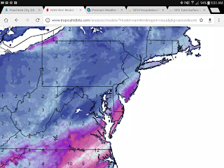
Model comes in literally every hour when your near an event, but when you are more then a day out, the Canadian and Euro run every 12 hours. The GFS runs 4 times a day as does the NAM (Short term american model) . There were no major changes at midnight, but the 6z or off hour runs have started to turn north. Last night, most data showed an inch at best in our area.. here are some maps..GFS, and several versions of the NAM based on resolution.


Anyways, pushing 2-4 inches now in Lynchburg and 1-2 in Roanoke. The noon model runs will either support or back off. 

Wednesday, January 4, 2017

When your crystal ball ain't so crystal clear..

For my longtime readers, you guys know when I am confident, I have no problem throwing out ideas early.  This is not the case...so, my plea is to keep expectations low :)
Glossary terms for shorter posts: EC- European model, GFS- American- GEM- Canadian.

The bad..

1.GFS isn't close and doesn't give much near us . Tremendous storm for eastern NC.
2. The Canadian is now good on wave 1, east on wave 2. We get 2 inches total, most Thursday night in Friday.
3. NAM- American regional model is south still.


The "wow"

European model has been consistent 3 runs in a row with 3-5 inches region wide and was a stronger system where 7-10 inches wasn't that far away (50-70 miles)

The Euro ensembles look better too-- for the first time. Ensembles are the model run 51 times with small changes to weed out model biases.

My thoughts-- someone has to blink soon. The EC being a better model is almost like those sprint ads where they say Verizon is better, but only 1% better...so, my confidence isn't booming, yet.

Timing-- Thursday evening, Flurries to an inch.

Friday night and Saturday- Holding at 2-4 region wide, not a locked in forecast.

Monday, January 2, 2017

About this possible event..

First, wow my last blog was bad. I expected no updates. The models were very wrong about the pattern and cold will come, leave and then come back in the time I thought would be mild.

Thursday may be a mess. Sometimes the worst traffic events come from small amounts of snow.. a slim coating is possible but with colder temps in place roads could get bad fast. I'd rather drive in 5 inches of snow when everyone knows to be safe then just a little when people don't take as much caution.

The writing could be on the all for Saturday for a BIG ticket event.  The EURO and GEM have not had it for days and those ensembles are not great either.  The GFS was great to watch rolling in but I had a hunch it was off. Here is why...


Speed of the short wave..

Wave one on Thursday is on the arctic front. Most storms need about 3 days or space or so to amplify (simply version) and some features in the Pacific Northwest likely eject the second piece of energy about 18 -24 hours too quickly... while the GFS shows it holding west a little more. (Credit to David Reese, Met from Charlottesville for the graphics,)


Note the blue dot over Oregon

This is the EURO...no Blue Dot.  The energy has already moved east. 


So, in summary I think the euro may be right on timing and the low doesn't develop as fast because the timing issue with that. Still, it could provide another period of light snow Friday Night and Saturday, with maybe decent snows into Eastern NC. 

Will do a more quick status updates after the model runs tonight..Even a weaker strung out low could edge north as we get closer. At this time, Thursday may be the best bet to whiten the ground in our general area and travel may be horrible for a while.

** Rememer if you like the content, click an add in appreciation. **