Winter Storm watches are out for everyone in our region for a little snow, some sleet then ice.
The basic set up is we have a piece of the polar vortex moving across New England pushing cold air into our region at the same time the "south east ridge" ridge means warmth in weather terms. This battle between the warm and cold will make for very moisture laden system with precipitation amounts of 1 to maybe 1.5 inches.
I'm somewhat optimistic at this point that it will be a serious winter storm in the NRV to ROA to LYH with some icing concerns but we may just see enough sleet to mitigate HUGE issues with our power grid. (May, not a lock yet) This could keep freezing rain total UNDER a catastrophic level. Southside is another issue where they will get mostly freezing rain. As bad as the Farmville to Charlotte to Halifax area saw, this could be worse and more wide spread with more precipitation and colder tempatures.
1. It may be a smidge colder, especially early on. You may be shocked to know that ice builds up more at 29 degrees than 31 or 32.
2. It may rain harder, which is actually a good thing with freezing rain because it can't freeze fast enough but the duration will likely offset this.
Basic Details:
Snow sleet and freezing rain develop overnight Wednesday into Thursday. Midnight to 4 am)
Southside: Quick burst of sleet to freezing rain. This will have a huge impact on the power grid. An inch or more of freezing rain will fall and build up on trees, power lines etc. I expect serious issues in this region with long term power outages. Ice build up will be greater than a half inch most areas. It may take days to restore power.
North of an Amherst to Daleville line, precipitation may start as an inch or two of snow, then sleet.
** Caveat** The GFS blast a quick burst of snow from the NRV to Charlottesville that is in the 4-8 inch range before ice. I don't think it's going to happen but wanted to throw it out there. This gives Lynchburg an inch or two at the same time before any sleet falls.
NRV to Roanoke to Lynchburg-
A quick burst of snow will flip to sleet. We should see a good bit of sleet before freezing rain because the "warm layer" sits pretty high, above 5000k feet and from that point to the ground is a solid 3--6 degrees below freezing. That's a classic sleet signal. We could see between 1-4 inches of quick burst of snow then mainly sleet. This should eventually mix with then become freezing rain and we will get a quarter inch of freezing rain build up. Most places had that in this past event, so I think we can mostly survive without HUGE power issues. With that, this is a Fragile forecast because if we change to freezing rain sooner, the Ice build up and power outages will be greater.
For this region, I mostly see 1-4 inches of sleet, then freezing rain of about .25 build up. This is close to a crucial breaking point but hopefully we stat at this level.
Temperatures may creep above freezing later Thursday but the damage will be done. We have better antecedent cold air, so there is a shot we remain at 31-32 until Friday AM.
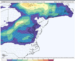
I'll pop some images on the bottom of this post but here are two- the top is predicted sleet and ice accumulation from the RGEM model. Note the sleet is total in inches and that in general 1 inch of rain is 3 inches of sleet. (meaning that most those in that area see an inch of precipitation fall as sleet. Also note that the freezing rain map counts all that has fallen but it all won't freeze because when it is HEAVY freezing rain much runs off before it freezes. With that, those totals over 1.5 inches will be catastrophic. (At this point, those in Southside and Northern NC)


