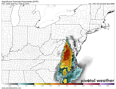
First, another storm will impact our region earlier in the week and bring a round of showers. I don't anticipate severe storms with this event.
A pretty strong cold front will push into our region with some very cold air for the time of year. A storm will form and impact our region.
Model break down:
GFS- Yesterday the model was very fast bringing in the cold air and pushed the low WELL south, it was a MONSTER storm over North Carolina with the heavy snow band reaching the VA/NC border and the 4 inch line reaching 460. Model runs since then lost the storm.
Canadian: Pretty much has nothing.
Euro: Has some consistency bring a low due east. There isn't much wiggle room at all as we are on the southern fringe of accumulating snows. I'm not able to post the "paid" snow map I get but the 4-6 inch line basically runs along 460 and basically at the VA/NC line there isn't much snow at all.
7 PM Thursday- Low pressure is near Nashville. You can see a High Pressure building in as well noted over MN/WI area. On the precipitation maps, snow has broken up north of our region along the Mason Dixon line.
24 hours later our low is a couple hundred miles off shore and has strengthened nicely.
Many details to work out. The euro "spits out" 5 inches of snow in LYH and ROA but as the storm approaches, at 1 AM we are actually warm enough for mix or even just rain east of the Blue Ridge, but then as the low wraps up we kick over to a fast heavy period of heavy snow. (* I can't post the pay euro maps, but these are the free ones in 24 hour increments that don't show precipitation or snow.
From Charlottesville to Northern Delaware, as the storm blows up the heavy snow that blows up near us really impacts them an dumps 8-14 inches.
If you don't want snow-- Speed the storm up and don't let he cold air get in place. THis would result in a more north storm track.
If you want MORE snow- slow the storm up, get the cold air in faster. Rather than a Nashville to Boone to Greensboro track, get a Chattanooga to Charlotte track. That extra 75 miles will make all the difference.
The storm BOOKS out of here Friday Morning and Friday afternoon temps are back into the 40's via the European model.. March snows, in fast and out fast.
My thoughts: There are some reasons why we could see a more suppressed track with cold air moving in. However, many reasons why we could see this thing trend 100 miles north and we just get a few rain showers too. No call yet, but my inclination is to expect a more northern track at this point.


