Tomorrow: Our storm we tracked last week for Wednesday is now going well west and presents a severe weather threat. Now, there are factors that could limit this, especially areas along and west of the Blue Ridge. With that, I wanted to make you all aware of this.
Looking at SIM radar, it seems two waves of showers and storms come through, the second being the greatest threat to have tornadic activity.

This is Radar right around 5 with the second round moving through.
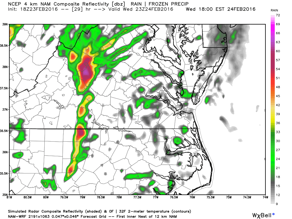
You can see our storm starts near SML and strengthens as it moves rapidly NE from there.

4pm MAP of greatest risk for Tornado..

One hour later the risk has shifted east.
I'm honestly skeptical places just north of Martinsville to just south of Lynchburg see severe storms. There will be a cold air wedge in places and the models QUICKLY move out the wedge and then stir up some storms.

Not our area temps in the 40's with much warmer air to our east. at 1PM

3 hours later, we've spiked to near 60 and Tornadic cells are are supposed to form. Now, I'd never rule out anything from happening but I can't remember a time where in our area that we've had a wedge break and tornadic cells pop up that quickly. I would contend that based on climatology alone, the highest risk is east of a line from Danville to Pamplin. With that, please be aware of all the weather reports and be cognizant of all watches and warnings issued tomorrow. If the sun pops out late morning early afternoon, it could mean game on. I'll tweet out and FB update information as it comes available.
No comments:
Post a Comment