My confidence for my forecast for round one is about 75%.. It's been charging south, but that has to bottom out soon. Any changes could mean less sleet and rain in Lynhcburg/Roanoke and more snow. Of course, the north trend could appear late and we get more rain and sleet. I will amend these ideas as needed.
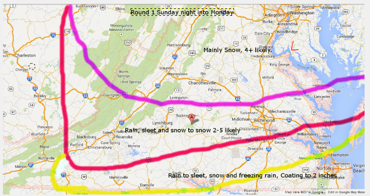
I think this map is pretty stable, will need to watch Roanoke to Lynchburg for change from sleet to snow. If everything goes right, we could eek out 6-7 inches along 460. 2-5 is a nice place to start

Round 2 is not a lock to happen. The remainder of the upper air energy is strong and creates another round of precipitation. We have a ton of cold air below 5k feet, but it's eroding above that. It may be some snow to start, but will transition to sleet and eventually freezing rain. Since most falls overnight, ice CAN build up, especially at night. Confidence is about 40-50% on this round.
I'll tweet/FB mid day model updates.
No comments:
Post a Comment