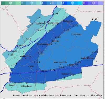
The fun and tricky part of this even is that is COULD end as snow, especially in the Mountain Empire, NRV, Highlands where an inch or two is possible and maybe even into Roanoke (Maybe a coating) Lynchburg may end as snow, but the last 2k feet are a tad warmer and I just can see a few gloppy flakes falling. I'm never a fan of these events as often the models are a little too slow pulling out precipitation and as that doesn't always equate to the cold air being faster with the snow. So, I like 1-2 in the higher elevations west of 81-- maybe 3-5 above 2500 feet. If your an 11 PM news watcher-- Wednesday night may have some flakes flying as far east as Lynchburg. The Storm is all but done by 2 AM- even in Lynchburg.
I've attached 2 MAPS-- one is from the 6z NAM-- it's not that aggressive on the western flank with snow and the second is the outlook from the HPC about where they think 4 inches or more is possible. It's pretty bullish, more bullish compared to my current thoughts.
 |
| HPC MAP- Best threat along 81-- |
 |
| NAM 6z- 1-3 inches along 81. For Giggle-- I will show the most aggressive model with snowfall- I think it's too aggressive and |
 |
| I think this is over done as it has an inch WELL into NC, south of Danville and the 3 inch line knocking at Lynchburg's door. |

No comments:
Post a Comment