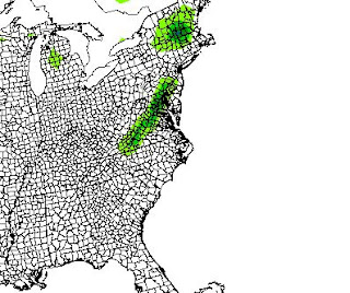
We currently have a strong short wave ( upper air energy) diving in from the MN region and it spans a storm that spins up and on some modeled data shows rain changing to snow for our area. (Not ALL areas-- seems to be mainly rain S and E of Lynchburg). Time frame on this event is Friday night into Saturday AM.
Here are a couple snow maps-- the first is made by the GFS and shows a strip of snow along and east of the Blue Ridge-- 1-2 inches.
Next, the ECMWF has the storm more amplified and the snow is MAINLY to our north, but-- its a ton of it!
Wild stuff!
I'd guess that there is some type of "abnormal" even happening, but I'm not convinced we see here. Hot Springs has a good shot, up into the Mts of WV, PA and NE from there- if anything changes, I will certainly update.


No comments:
Post a Comment