This event: As stated, Friday looked like a nice step towards a decent event, we had a backing off late Friday into Saturday and then last night a step back towards a decent event.
The floor of this event seems to be a coating to an inch for most places.
The ceiling seems to be a 3 to 6 inch snowfall.
Right now, the best bet is a 1 to 3 inch snowfall for most of my readers (Blacksburg, Danville, Roanoke and Lynchburg.
Somewhere, right now it seems to be favored east could end up more in that 3 to 6 range.
The basic set up.
There is a clipper system that has a cold front attached to it. The front slows down and a wave develops on it, enhanced by a strong jet aloft. So, there isn't really a "strong low: or really even any low at this point. If we do get a low developing faster, like the Euro showed on Friday we could end up with a decent event again.
The Euro last night was a little more bullish on the wave..
3 AM

6 AM

9AM
12pm

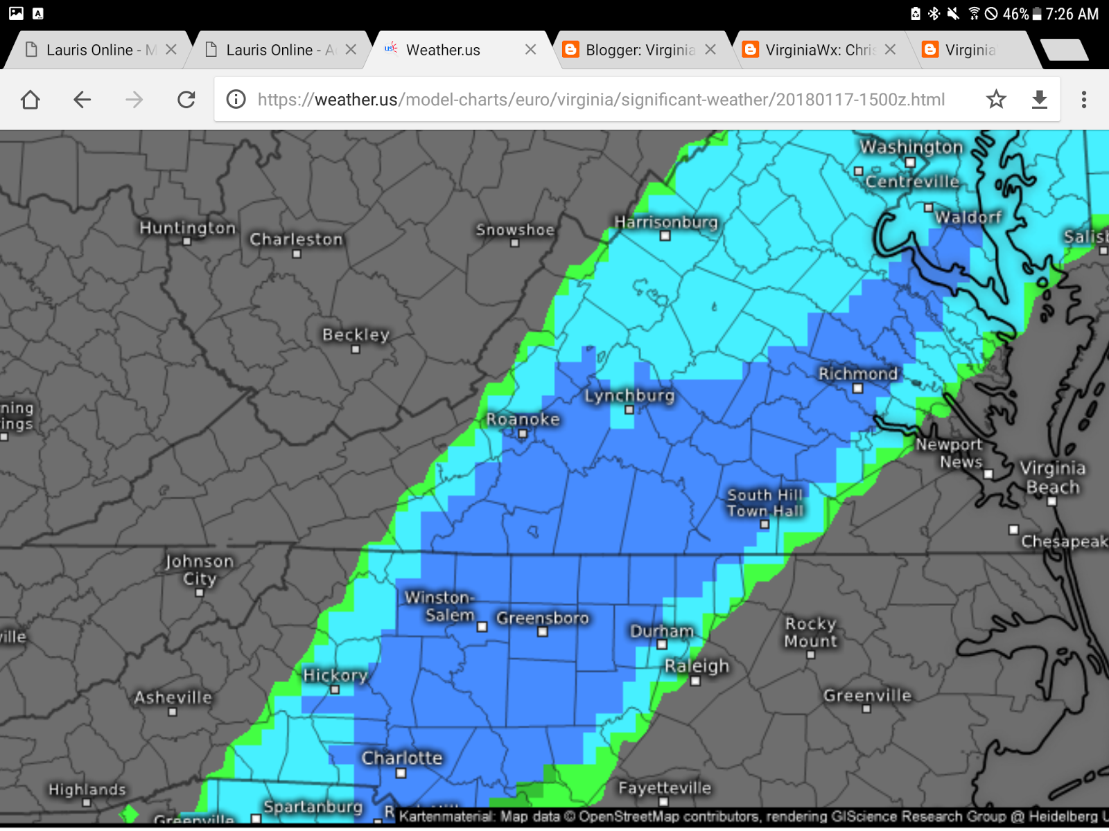
This is the total precipitation from the last run of the euro. The best enhancement is just east of Lynchburg, but about .25 falls in Lynchburg. This could move either way before Wednesday.


Not in this mapthe strong winds from the Jet stream (Lets say from 15k to 30k feet, flow is out of the southwest.
Summary:
At this point, Most areas are on target to see a 1-3 inch snow fall.
Some places, as show on that map, could see a bit more like 3 to 6. As of now, best locations may be east of Lynchburg but that will likely change a bit as get closer.
I will tweet out updates throughout the day and likley have a blog updated in the morning. Share this write up with your friends..
No comments:
Post a Comment