October is a BIG month when making a winter forecasts. Many venues have already released their outlooks and many are leaning near normal to below normal with normal to above normal snowfall in our region. Many of these were made when the El Nino looked to peak maybe close to +1c in regions 3/4 and this is NOT the case as of now. The El Nino has weakened and we could/should end up ENSO neutral going into the winter. (No El Nino or La Nina)
A west based El Nino that peaks as moderate late fall/early winter is our BEST chance of seeing an above normal snowfall winter. I've cited this over and over, but had we reached that point I'd be looking at predicting 150-200% of our normal snowfall. In our region, it tends to trump any other factors in the winter months. With this NOT being the case, we have to weight each global scale and I'm not ready to commit yet. With that, I'm not hedging cold and snowy at this point. One key factor will be Eurasian snow cover-- based on research by JL Cohen states that rapid snow cover increase in Eurasia in October is harbinger of a colder winter in the USA. In simple terms, the snow cover impacts the arctic jet, which weakens the polar vortex. This sounds backwards, but a weaker polar vortex allows for cold air to drift away from the pole while a stronger polar vortex tends to keep it bottled up.
So, I'm going to monitor the snow cover, keep reading processing data and punt until late month.
October 10 will be the 33 year annivesary of an amazing early season snowfall in the Lynchburg and Roanoke region.
In Roanoke, almost a half inch of snow fell with the mounts to the north getting upwards of 6-10 inches. I've read a report of 10 inches up in Covington/Hot Springs area. Lynchburg, VA was hit even harder with 2.4 inches of snow falling. Some places along and near Skyline drive had 12-17 inches.
What happened?
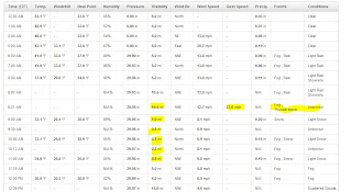
A slow moving cold front moved across the state while a low pressure formed along the front. The air was VERY cold for the time of year and the combination of a slow moving front along with the "upper air energy" creating strong lift pulled the cold air ALL the way down to the surface. Temps on the 9th had a high in the mid to upper 70's and the temp had cooled to only 53 degrees at midnight as the cold front approached the area. Moderate to almost heavy rain continued to near sunrise (While the higher elevations to our north had mainly snow) and as the upper air approach (with VERY cold air) Thunder and lightning was VERY common as heavy rain switched to heavy snow. VERY impressive for October 1979.
Rain in Lynchburg with thunder and some gusty winds, changes to snow around 8:30. Heavy snow continued till about 11 am with maximum depth of 2.4 inches.
Another link to some photos from the snow on the east coast.


