Sunday, February 19, 2012

Wholesale changes.

I've never been a fan of the "weatherman can get it wrong" half time time and still have a job. Can an accountant balance a ledger with estimates? If the estimate was $200 and the actual was $1200-- they will be way off. Weather forecasting is the same way- we use the data we have and hope the sample is accurate. This storm had so many moving parts it has been hard to gauge each one. And, as a result we've got to make some changes.

I should have mentioned there was a shot this thing ended up a little more suppressed. I really didn't see it was SUPER viable option, but it would have been prudent. My thinking was 50 mile wiggle room either way keeps us in close to 4 inches of snow. The wiggle was more like 75-100 miles. 

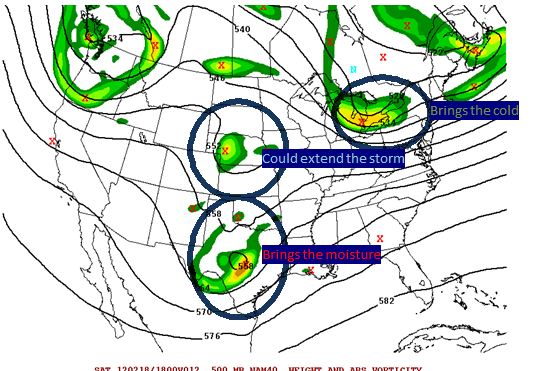
Model data has trended south and radar looks CLOSE to that portrayal. The  mechanism to deliver cold air (jet stream area) and has shunted it a little faster to our south. As a result:
1. We get less moisture.
2. We needed the heavier snow to overcome the warm ground. I had no issue saying the warm ground doesn't matter as long as the snow is falling a decent clip. We should get some type of a decent burst later today, but before we may have lighter sleet/snow and rain because it's light and we can capitalize on the lower dew points to drop the temps. So, we will have more rain than I first thought or snow that just won't accumulate this afternoon. 

Adjusted thinking. May do a map by mid day, not that it helps anyone at that point. 

NRV-- 4-6 inches.
Roanoke Valley 3-5
LYH 2-4 with 2 up in Amherst and 4 closer to Altavista. 
Southside- 4-8. 

In general being Northeast is bad and being South and Southwest is good. 

I can see a scenario where the banding still sets up north. Banding is NEVER modeled well-- despite all the changes in the models. As a result, Lynchburg has close to nothing at 5pm, everyone thinks its a bust and the storm strengthens and a band dumps 5 inches in 4 hours. This will have to be monitored. I don't want to sound like Princess Leah, but this could be our ONLY HOPE to get 5 inches in LYH. 

We are in nowcast mode-- Model data helps, but radar, water vapor matter more. Feel free to friend me on facebook or subscribe Keith David Huffman,  twitter @ VirginiaWx for current updates.

A short term model called the HRR keeps us dry all day, but creates a decent band LATER AFTERNOON-- this would be impressive for a few hours.


Saturday, February 18, 2012

Things seem on track for a nice winter event. I specifically wore short sleeves to my my sons basketball game to soak it all in. Overall, model data has held fast. I'd say that we are on tap for a liquid event of .6 to .9 along the 460 corridor from Blacksburg right into Richmond. Precipitation will be MAINLY snow, but the fist 1-2 hours could have some sleet and rain mixed in. Also, I expect a late afternoon early evening lull that could have some sleet and or freezing drizzle falling. Outside of that, mainly snow. Even Danville should do a little better snow wise.

I expect a strong push of mix changing to snow, and a lull later, followed by colder temps and a second push of heavy snow due to the approaching vort going to our south. That could produce some heavy snow rates Sunday evening. Timing wise, the slow down has been about perfect for our region if you wanted a good snow. 

What could go wrong?

I have some concerns about the total precipt that the one vort circled earlier that could crush our wave enough to pull us down to a half inch or so of liquid. Also, while I'm not really worried about temps, that's always got to be a thought if we mix more then I anticipate. 

What about the warm ground?

 Over rated, over rated, and over rated. If it was marginal cold aloft falling to temps at the surface of 33, I'd have concerns. Yeah, it's not going to lay on the road fast-- but grass, cars, benches decks will have accumulations fast. When the "lull" I talked about, you may settle and lose some depth-- let's say you have three inches at the end of round 1, it may condense to 2.5 inches and you get another 4 on the back side. You had 7 inches fall still. With that, temps are very cold-- just above the surface we will have temps at .-5 c at times. It's not going to be a "wet" snow other then the surface temps won't be bitter. I can even see the evening action being almost powder like. Citing examples-- 09, 05, 01 all had events where the temps were well into the 50's the day before. Feb 22 01 I played basketball in shorts and we had a 2-4 inch storm the next day. The bulk came in 2-3 hours in the morning and when it slowed, that snow did NOT melt. 

Start times- Far SW around Sunrise-- 10-11 am in LYH. End time? 10 PM far SW, 2 AM East of LYH.  

Some mixing and just a tad warmer overall keeps Martinsville to Danville and over to South Boston a little low. Now, when that second piece of energy dives in, they may catch up well. 

As for my map, the bulk of my focus is the Blacksburg Warning area. If you're outside that region, shoot me a message and I can look up more specifics in your region. I also didn't do much for NC-- there is some uncertainly everywhere, include those from 40 up to the NC/VA state line. Second wave could cash them in with a decent event. 

My thinking as of now. May have to massage a little here or there, but I like how this looks. 

Final call

Water, water, every where, Nor any drop to drink.

Fun, interesting storm to follow. Model data has now literally done a complete reversal on some levels and some data has suggested we miss the best snows to our SW and even S rather than N and NW.

What's going on?
The overall storm has slowed. We have three moving pieces as shown below. This are the upper air energy, "swirl's" they call them on storms associated with our storm. They are about 17k feet about the ground.


Brings then cold--- has raced out in front and will help deliver cold air from the north. From west of the Blue Ridge to north of 460, I do expect mainly snow.
Brings the moisture--Has slowed just a tad and won't bring the goods until later. I can see Lynchburg not starting until NOON now. 
Could extend the storm-- one final piece of energy dives in behind our storm and will let lighter snow linger. Depending on the exact timing, this could add a little more snow as it works with the brings the moisture.

I'm going to wait till mid afternoon for full map update. As of now, I like the "let's add 2 inches to everyone from yesterday, except the far north reaches of my map. They likely won't get as much total precipitation. 

For the record, don't fret the NWS not issue a watch for LYH. Reading their office discussion, they are still talking about rain starting before sunrise. The slower trend will hold it off. I'm assuming they didn't fully digest the new runs. Not much, if any data shows it much, if any rain after noon. Sleet, maybe but not rain. A this moment, I see LYH getting 4-6 inches on grass, cars and porches, and 2 inches of slush on pavement, etc

Friday, February 17, 2012

If you ain't first, you're last!!

12z Model data is confirming that a colder, snowier solution is becoming more likley. With that, I'm opting to NOT attempt to be the first go bigger, but try to be give an honest presentation of where things sit.

With that, my statement of adding two inches to my first guess seems more and more likely. However, in terms of "wiggle room". I can see 50 miles of wiggle room on the models. 50 mile wiggle north moves LYH from 6-7 inches on the GFS to 2-3 inches. 50 miles wiggle south on the NAM moves LYH into well over a foot (as modeled)

We've got a ways to go here-- I'd expect winter storm watches by either later this afternoon or early Satuday. (Excluding southside)

Full update during late evening model runs.

Is it Raining, Is it Snowing, is a Hurricane-a-Blowing??

Yes! The danger must be growing, for the rowers keep on rowing!!!- Willie Wonka

Challenging forecast on deck--

Literally ALL of the model data has shifted south in the last 24 hours. That's a colder and snowier solution for those of you paying attention at home. The short and sweet version is a piece of energy out runs the storm forces cold air towards us. Associated with that cold air is a stronger jet. This stronger jet also beats the storm up pretty good with a strong jet that comes along with the cold air. 

Further complicating this is the potential for a severe weather outbreak. If the thunderstorms develop, which there is moderate risk, if the orientation isn't right it can reduce moisture influx, at least for a while. 

With so many moving parts, it will be hard to nail down a forecast-- but I do believe we break the shut out of snow this winter in Lynchburg proper. 

The Breakdown- Saturday will make you question whether it will even be able to snow as temps will be over 50. Clouds roll in late and temps fall over night to the upper 30's as rain starts. I think it quickly mixes with snow and sleet, and flips to mainly snow by noon for Blacksburg to Lynchburg. Snow could fall heavy at times for a while and ends late in the evening Sunday. (Lighter snow after 5 PM)

The storm has tended to slow down on the model data and that's a good thing. With that, systems often run faster then modeled. This could be an issue with timing of the cold air-- it's my experience that even if the storm runs faster, doesn't mean the the cold air will be faster. However, we will have tremendous forcing aloft  with the cold air pushing down from the south, strong sub tropical jet to the north-- this creates lift and lift cools the air. 

My map- disclaimer. I focuse mainly on Central and SW VA-- the father away you get, the less I know about your micro climate. If your in grandma's cabin in WV, I've not studied your area in depth. 


My call as of now!
With a ton of variability this is not my final call. With that, if the WARMER solution happens, I'd subtract 2 inches in the green and blue zones and ADD some to the magenta. Anything outside of the blue would end as snow, but just a coating to an inch. 

if the Colder solution verifies, very possible to add 2 inches in the green, blue and yellow zones. 


Thursday, February 16, 2012

This or that?

I'm going to throw a quick update now and then see what I can do after the late evening data. Closing out a market at work, so I may just need to sleep. (Unlikely, but sounds noble)

In short, MOST of the model data came in with a more southerly track, with colder temps. Now, this isn't random and there are sound reasons why this could be closer to final track. Basically, southern piece of energy coming out of Mexico is a tad slow, the northern energy races ahead and JUST in time cools the atmosphere. With the northern jet, we have stronger confluence and that doesn't allow the storm to gain latitude and the flow is fast so it rockets off to the east north east.

I'll put out an outlook map later this evening-- as of now, I think the best snows are Staunton, Waynesboro and Harrisonburg due best. However, with the more south trend, the NRV could be in play due to their elevation. Elevation will make a difference. My theory is the change over may be pretty fast getting from lets say Blackburg to Lynchburg-- like within an hour, but Blacksburg is accumulation 3 hours earlier because they don't have to cool the last 1200 feet.-- so there is a slushy coating in Lynchburg and Blacksburg has 2-3 inches.

Silence speaks as loud as war...

This has literally been the most boring winter ever-- at this point outside the mountains we have no Winter Storm Watches, ONE Freezing Rain Advisory that never materialized and on that should have been expanded into Lynchburg. That's it.

There's been an event on the models for several days, and the pattern has looked good for a week or so. I've not blogged, honestly because it's been such a bad winter-- ehh, I'm rusty.

I'll do a more complete update but here is a brief overview-

Energy in the SW states slides east and interacts with  some energy diving south out of the Pacific north west. Not a SUPER strong storm, but it will be a very wet system with a good tropical connection. Regardless of track, I think most of our CWA (forecasting area covered from the NWS Blacksburg office) will see a .75 to 1.25 liquid event. The issue will be timing of the cold air to how much we snow falls.

As of now, I think most of the region starts as rain, but changes to snow before ending. How quickly is the key point. Models have trended colder and wetter, but that doesn't mean that will continue. I'd target Charlottesville west towards Lexington as the higher risk areas of getting a "winter storm warning" type snow (4-5 inches). Much is up in the air still..

I'm a bit under the weather and have an early conference call-- Full update later this evening.